Related Images


Download:
| Tiny | 160x128 | View | Download |
| Original gif | 240x192 | View | Download |
| Original as jpg | 240x192 | View | Download |
This image was acquired from
wikimedia. It was marked as Public Domain or CC0 and is free to use. To verify, go to the source and check the information there.
Looking for more info about this image?
Try a Google Reverse Image Search for it.
Try a Google Reverse Image Search for it.
Keywords from Image Description:
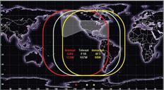
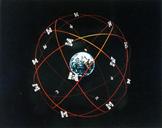
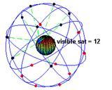
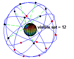
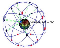
ConstellationGPS. simulation of the original design of the GPS space segment with GPS satellites satellites in each of orbits showing the evolution of the number of visible satellites from fixed point on earth considering visibility as having direct line of sight The parameters used to simulate the orbits are eccentricity inclination