
Related Images


Download:
| Tiny | 214x128 | View | Download |
| Small | 429x256 | View | Download |
| Medium | 859x512 | View | Download |
| Original | 960x572 | View | Download |
This image was acquired from
flickr. It was marked as Public Domain or CC0 and is free to use. To verify, go to the source and check the information there.
Looking for more info about this image?
Try a Google Reverse Image Search for it.
Try a Google Reverse Image Search for it.
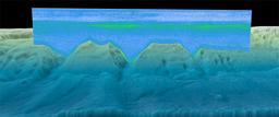
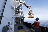
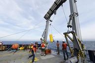
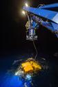
Keywords from Image Description:
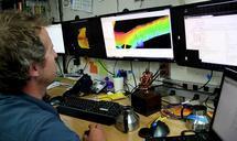
sonar ocean ocean science oceanscience biogeography u.s. virgin islands usvirginislands noaa national ocean service nationaloceanservice coral coral reef coralreef fish seafloor nautical chart nauticalchart Hydrographer Mike Stecher converts sonar data into imagery. The data collected during the mapping cruise is also used to update