Related Images


Download:
| Tiny | 150x128 | View | Download |
| Small | 301x256 | View | Download |
| Medium | 603x512 | View | Download |
| Original png | 760x645 | View | Download |
| Original as jpg | 760x645 | View | Download |
This image was acquired from
wikimedia. It was marked as Public Domain or CC0 and is free to use. To verify, go to the source and check the information there.
Looking for more info about this image?
Try a Google Reverse Image Search for it.
Try a Google Reverse Image Search for it.
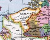
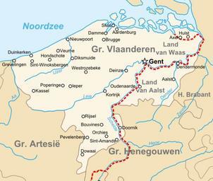
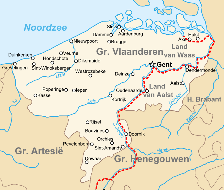
Keywords from Image Description:
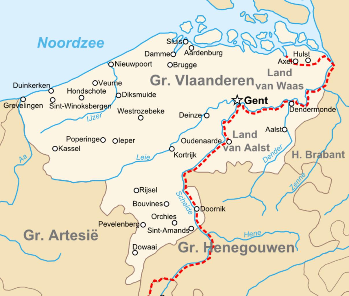
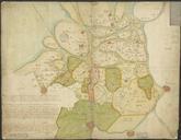
County of Flanders topogaphy. en Map of the en County of Flanders in the late th centry nl Kaart van het nl Graafschap Vlaanderen in de Tweede helft van de eeuw own Sir Iain Maps of the county of Flanders Maps of the history of Belgium Maps of Flanders