
Related Images


Download:
| Tiny | 117x128 | View | Download |
| Small | 234x256 | View | Download |
| Medium | 469x512 | View | Download |
| Large | 939x1024 | View | Download |
| Original tiff | 5248x5723 | View | Download |
| Original as jpg | 5248x5723 | View | Download |
This image was acquired from
wikimedia. It was marked as Public Domain or CC0 and is free to use. To verify, go to the source and check the information there.
Looking for more info about this image?
Try a Google Reverse Image Search for it.
Try a Google Reverse Image Search for it.
Keywords from Image Description:
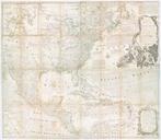
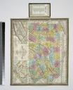
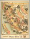
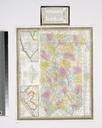
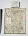
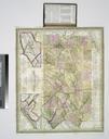
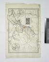
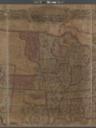
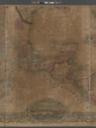
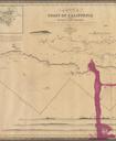
County map California Map of the settlements in the Great Salt Lake country Utah inset San Francisco Bay and vicinity inset. NYPL. County map California Map of the settlements in the Great Salt Lake country Utah inset San Francisco Bay and vicinity inset Atlases gazetteers guidebooks and other books Mitchell's new general atlas