Related Images


Download:
| Tiny | 153x128 | View | Download |
| Small | 307x256 | View | Download |
| Original gif | 600x500 | View | Download |
| Original as jpg | 600x500 | View | Download |
This image was acquired from
wikimedia. It was marked as Public Domain or CC0 and is free to use. To verify, go to the source and check the information there.
Looking for more info about this image?
Try a Google Reverse Image Search for it.
Try a Google Reverse Image Search for it.
Keywords from Image Description:
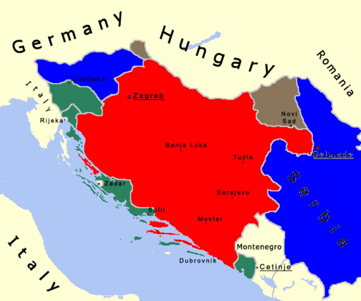
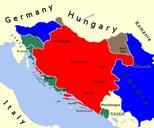
Croatia en. English map of Indipendent State of Croazia The red area shows NDH the green area shows Italian annexations the brown one shows the Hungarian annexations and the blue one shows the German annexations Own Bukkia Maps of the Independent State of Croatia Maps of Serbia during World War II Maps of Montenegro during World