
Related Images


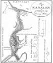


Download:
| Tiny | 157x128 | View | Download |
| Small | 314x256 | View | Download |
| Medium | 628x512 | View | Download |
| Original png | 995x811 | View | Download |
| Original as jpg | 995x811 | View | Download |
This image was acquired from
wikimedia. It was marked as Public Domain or CC0 and is free to use. To verify, go to the source and check the information there.
Looking for more info about this image?
Try a Google Reverse Image Search for it.
Try a Google Reverse Image Search for it.
Keywords from Image Description:
Denmarkmap . en Kelisi Map of Denmark showing main towns highest point and other information This map was created at Online Map Creation and may be considered PD This map's source is aquarius ifmgeomar de here with the uploader's modifications and the soest hawaii edu GMT homepage says that the tools are released under the GNU