
Related Images

Download:
| Tiny | 97x128 | View | Download |
| Small | 194x256 | View | Download |
| Medium | 388x512 | View | Download |
| Large | 777x1024 | View | Download |
| Original | 1446x1905 | View | Download |
This image was acquired from
wikimedia. It was marked as Public Domain or CC0 and is free to use. To verify, go to the source and check the information there.
Looking for more info about this image?
Try a Google Reverse Image Search for it.
Try a Google Reverse Image Search for it.
Keywords from Image Description:
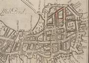
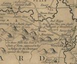
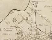
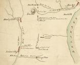
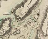
Detail of Erskine Map of Quaker Hill. en Detail of map showing Quaker Hill Pawling New York The map was drawn for George Washington's use by Robert Erskine geographer with the Continental Army The map shows the Ferris property the Reed Ferris House served as Washington's Headquarters September to and the John Kane House Washington's