
Related Images


Download:
| Tiny | 231x128 | View | Download |
| Original png | 416x230 | View | Download |
| Original as jpg | 416x230 | View | Download |
This image was acquired from
wikimedia. It was marked as Public Domain or CC0 and is free to use. To verify, go to the source and check the information there.
Looking for more info about this image?
Try a Google Reverse Image Search for it.
Try a Google Reverse Image Search for it.
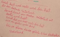
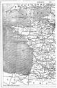
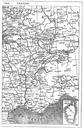
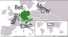
Keywords from Image Description:
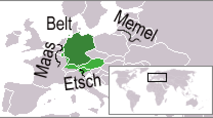
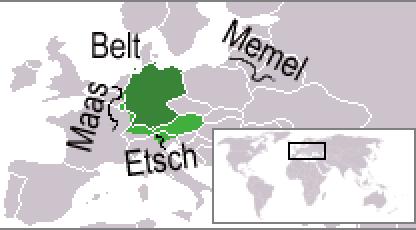
DeutschlandliedGeographie. Map indicating geographical borders Maas Memel Etsch Belt of German speaking areas as mentioned in the first stanza of the en Deutschlandlied of compared to current political borders and the areas where German is spoken today marked green en Isthmus Own work of the uploader based on File LocationGermany