Related Images


Download:
| Tiny | 165x128 | View | Download |
| Small | 330x256 | View | Download |
| Medium | 661x512 | View | Download |
| Original png | 770x596 | View | Download |
| Original as jpg | 770x596 | View | Download |
This image was acquired from
wikimedia. It was marked as Public Domain or CC0 and is free to use. To verify, go to the source and check the information there.
Looking for more info about this image?
Try a Google Reverse Image Search for it.
Try a Google Reverse Image Search for it.
Keywords from Image Description:
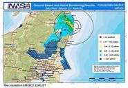
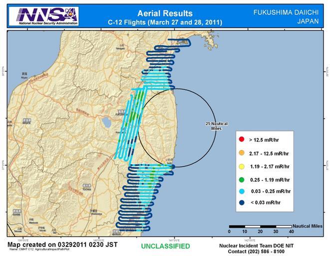
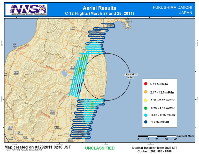
DOE NNSA Fukushima Survey March . en This image specifically blocks out the high dose rate area close to the plant in order to display the gradients at further locations The dates of the images are consistent with there being just one plane doing the flying this was apparently done in series with the other March and update Aerial