
Related Images


Download:
| Tiny | 127x128 | View | Download |
| Small | 255x256 | View | Download |
| Original png | 440x441 | View | Download |
| Original as jpg | 440x441 | View | Download |
This image was acquired from
wikimedia. It was marked as Public Domain or CC0 and is free to use. To verify, go to the source and check the information there.
Looking for more info about this image?
Try a Google Reverse Image Search for it.
Try a Google Reverse Image Search for it.
Keywords from Image Description:
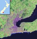
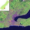
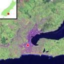
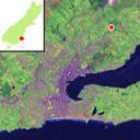
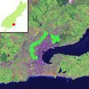
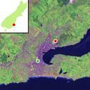
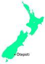
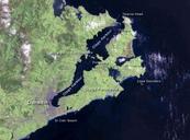
DunedinSatmap. Satellite map template of inner Dunedin New Zealand Based on NASA satellite map own File Otagoharbourlandsat as base image NASA public domain photography changed James Dignan Dunedin New Zealand User Grutness Grutness en File Dunedin New Zealand location map Grutness Original upload log en Quadell CommonsHelper