
Related Images


Download:
| Tiny | 224x128 | View | Download |
| Small | 448x256 | View | Download |
| Medium | 896x512 | View | Download |
| Original | 1113x636 | View | Download |
This image was acquired from
wikimedia. It was marked as Public Domain or CC0 and is free to use. To verify, go to the source and check the information there.
Looking for more info about this image?
Try a Google Reverse Image Search for it.
Try a Google Reverse Image Search for it.
Keywords from Image Description:
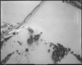
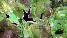
Dunford Bridge Aerial RLH. Aerial image of Dunford Bridge Self using CorelDraw to compile single image from several old images provided from the USGS Richard Harvey Maps of South Yorkshire Peak District