
Related Images


Download:
| Tiny | 153x128 | View | Download |
| Small | 306x256 | View | Download |
| Original png | 548x458 | View | Download |
| Original as jpg | 548x458 | View | Download |
This image was acquired from
wikimedia. It was marked as Public Domain or CC0 and is free to use. To verify, go to the source and check the information there.
Looking for more info about this image?
Try a Google Reverse Image Search for it.
Try a Google Reverse Image Search for it.
Keywords from Image Description:
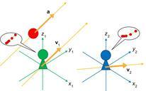
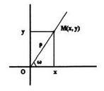
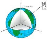
Earth Centered Inertial Coordinate System. en To show location about the earth using the ECI system the Cartesian Coordinates are used The xy plane coincides with the Earth equatorial plane The axis is permanently fixed in direction relative to the celestial sphere which does not rotate like the Earth does The axis lies at angle