
Related Images


Download:
| Tiny | 170x128 | View | Download |
| Small | 341x256 | View | Download |
| Original png | 600x450 | View | Download |
| Original as jpg | 600x450 | View | Download |
This image was acquired from
wikimedia. It was marked as Public Domain or CC0 and is free to use. To verify, go to the source and check the information there.
Looking for more info about this image?
Try a Google Reverse Image Search for it.
Try a Google Reverse Image Search for it.
Keywords from Image Description:
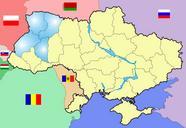
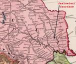
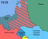
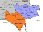
East Galicia and Volhynia . Map of the southeastern part of Poland within the borders of as well as the eastern part of Volhynia Highlighted in orange colour are the three Polish voivodeships of Lww Stanisaww and Tarnopol which form the eastern part of Galicia Areas in grey are other Polish voivodeships In blue the Polish voivodeship