
Related Images


Download:
| Tiny | 179x128 | View | Download |
| Small | 358x256 | View | Download |
| Medium | 716x512 | View | Download |
| Original | 1200x858 | View | Download |
This image was acquired from
wikimedia. It was marked as Public Domain or CC0 and is free to use. To verify, go to the source and check the information there.
Looking for more info about this image?
Try a Google Reverse Image Search for it.
Try a Google Reverse Image Search for it.
Keywords from Image Description:
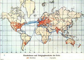
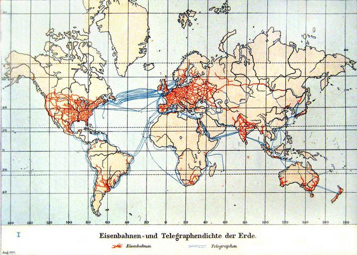
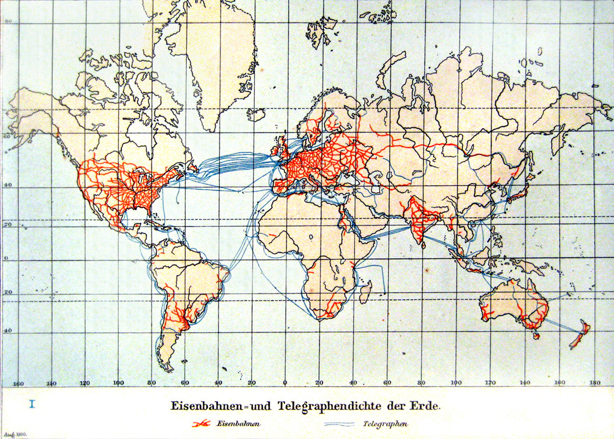
Eisenbahnen und Telegraphendichte der Erde um . Eisenbahnen und Telegraphendichte der Erde um Kopie aus Andrees Handatlas von Kolonial und Weltverkehrskarte World Map of the Railway and Telegraph Network Density at Copy from Andrees Handatlas Kolonial und Weltverkehrskarte Andrees Handatlas Auflage Herausgegeben Albert Scobel