This image was acquired from
wikimedia. It was marked as Public Domain or CC0 and is free to use. To verify, go to the source and check the information there.
Looking for more info about this image?
Try a Google Reverse Image Search for it.
Try a Google Reverse Image Search for it.
Keywords from Image Description:
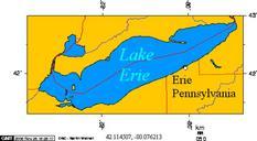
Erie Triangle. Black line indicates southern border of Erie Triangle within Erie County Foundation map created via National Atlas online mapmaker publicdomain resource of the government jengod publicdomain resource of the government Maps of the history of the United States PDUSGov


