This image was acquired from
wikimedia. It was marked as Public Domain or CC0 and is free to use. To verify, go to the source and check the information there.
Looking for more info about this image?
Try a Google Reverse Image Search for it.
Try a Google Reverse Image Search for it.
Keywords from Image Description:
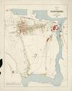
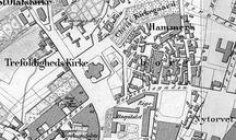
Etterstad kart . Kart over Etterstad stre Aker Bygdevegen fra Kristiania til Strmmen gr forbi garden Innafor Kristianias grense ses noe av bebyggelsen Vlerenga Kart over Kristiania FemtiaarsBeretning om Christiania Kommune for Aarene Kristiania kommune PDold byarkivet oslo kommune no html Old maps of Oslo Etterstad

