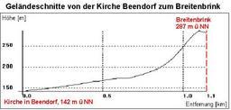
Related Images


Download:
| Tiny | 117x128 | View | Download |
| Small | 235x256 | View | Download |
| Medium | 470x512 | View | Download |
| Large | 940x1024 | View | Download |
| Original | 1177x1281 | View | Download |
This image was acquired from
wikimedia. It was marked as Public Domain or CC0 and is free to use. To verify, go to the source and check the information there.
Looking for more info about this image?
Try a Google Reverse Image Search for it.
Try a Google Reverse Image Search for it.
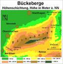
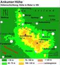
Keywords from Image Description:
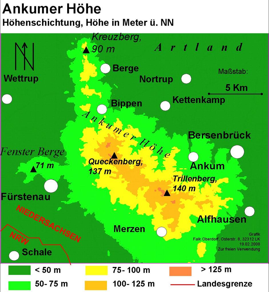
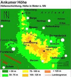
Falk Oberdorf Ankumer Hhe physisch. Karte der Ankumer Hhe Map of the Ankum Heights Lower Saxony Germany own original text selbst erstellt Falk Oberdorf Osterstr Lbbecke FalkOberdorf Mr CET PDrelease original upload log page de FalkOberdorfAnkumerH Bhephysisch FalkOberdorf bytes no Andere Versionen Ankum Maps of Lower