
Related Images


Download:
| Tiny | 160x128 | View | Download |
| Small | 320x256 | View | Download |
| Medium | 640x512 | View | Download |
| Large | 1280x1024 | View | Download |
| Original | 3002x2400 | View | Download |
This image was acquired from
flickr. It was marked as Public Domain or CC0 and is free to use. To verify, go to the source and check the information there.
Looking for more info about this image?
Try a Google Reverse Image Search for it.
Try a Google Reverse Image Search for it.
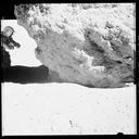
Keywords from Image Description:
erts earth resources technology satellite earthresourcestechnologysatellite mss multispectral scanner system multispectralscannersystem blackandwhite white background black and white giant photo map of the contiguous states of the United States the first ever assembled from satellite images completed for NASA by the U.S. Department