
Related Images


Download:
| Tiny | 159x128 | View | Download |
| Small | 318x256 | View | Download |
| Medium | 636x512 | View | Download |
| Original png | 679x546 | View | Download |
| Original as jpg | 679x546 | View | Download |
This image was acquired from
wikimedia. It was marked as Public Domain or CC0 and is free to use. To verify, go to the source and check the information there.
Looking for more info about this image?
Try a Google Reverse Image Search for it.
Try a Google Reverse Image Search for it.
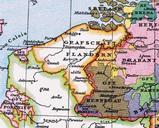
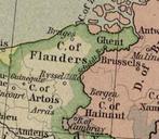
Keywords from Image Description:
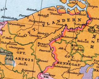
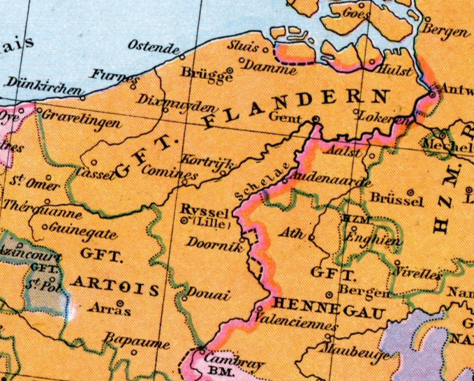
Flandern . en County of Flanders and surrounding territories in the th century de Grafschaft Flandern im Jahrhundert Johann Gustav Droysen Allgemeiner historischer Handatlas in Karten mit erluterndem Text Velhagen Klasing Digitalized version Johann Gustav Droysen pl karte PDold Old maps of Flanders