Related Images


Download:
| Tiny | 165x128 | View | Download |
| Small | 331x256 | View | Download |
| Medium | 662x512 | View | Download |
| Large | 1325x1024 | View | Download |
| Original png | 1732x1338 | View | Download |
| Original as jpg | 1732x1338 | View | Download |
This image was acquired from
wikimedia. It was marked as Public Domain or CC0 and is free to use. To verify, go to the source and check the information there.
Looking for more info about this image?
Try a Google Reverse Image Search for it.
Try a Google Reverse Image Search for it.
Keywords from Image Description:
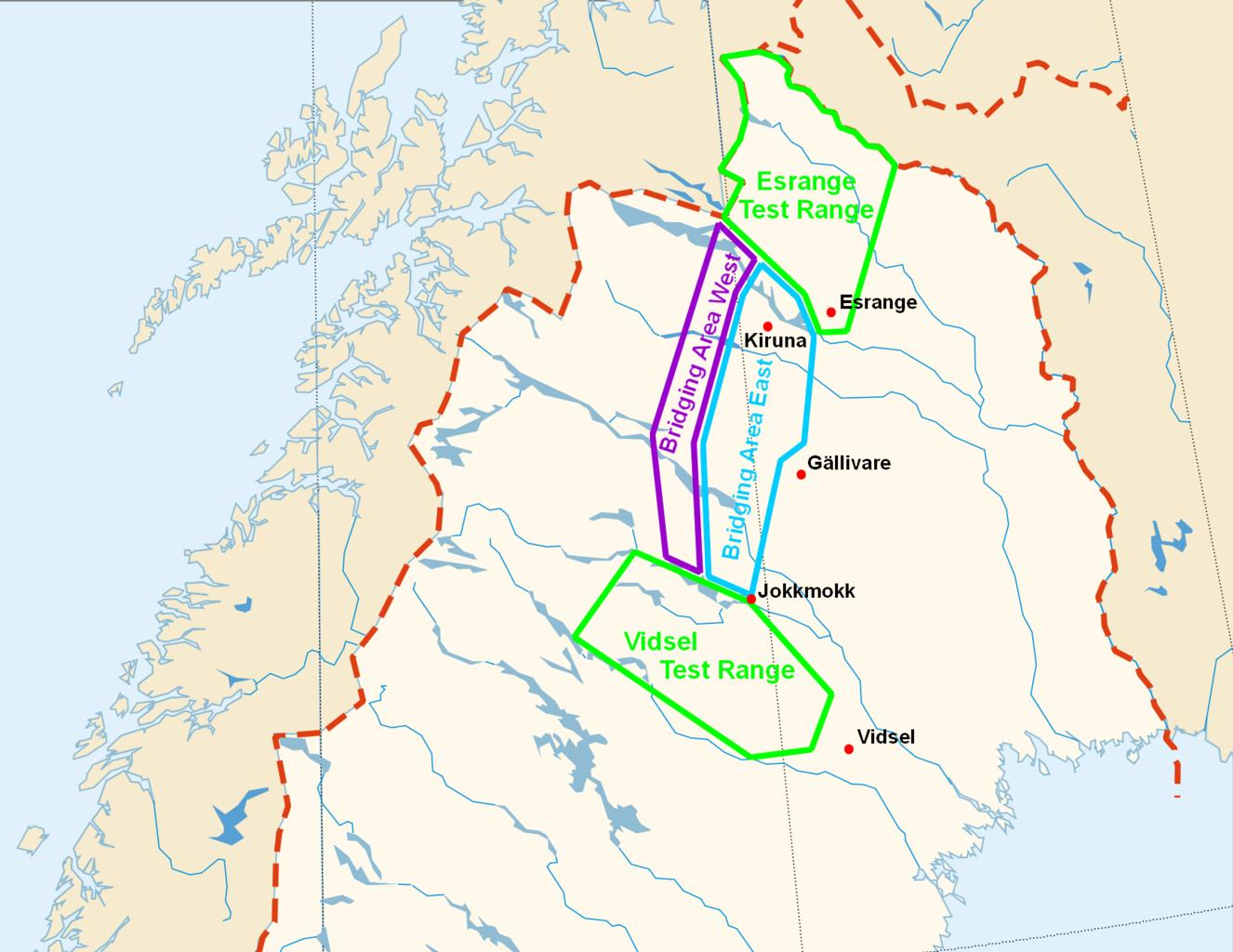
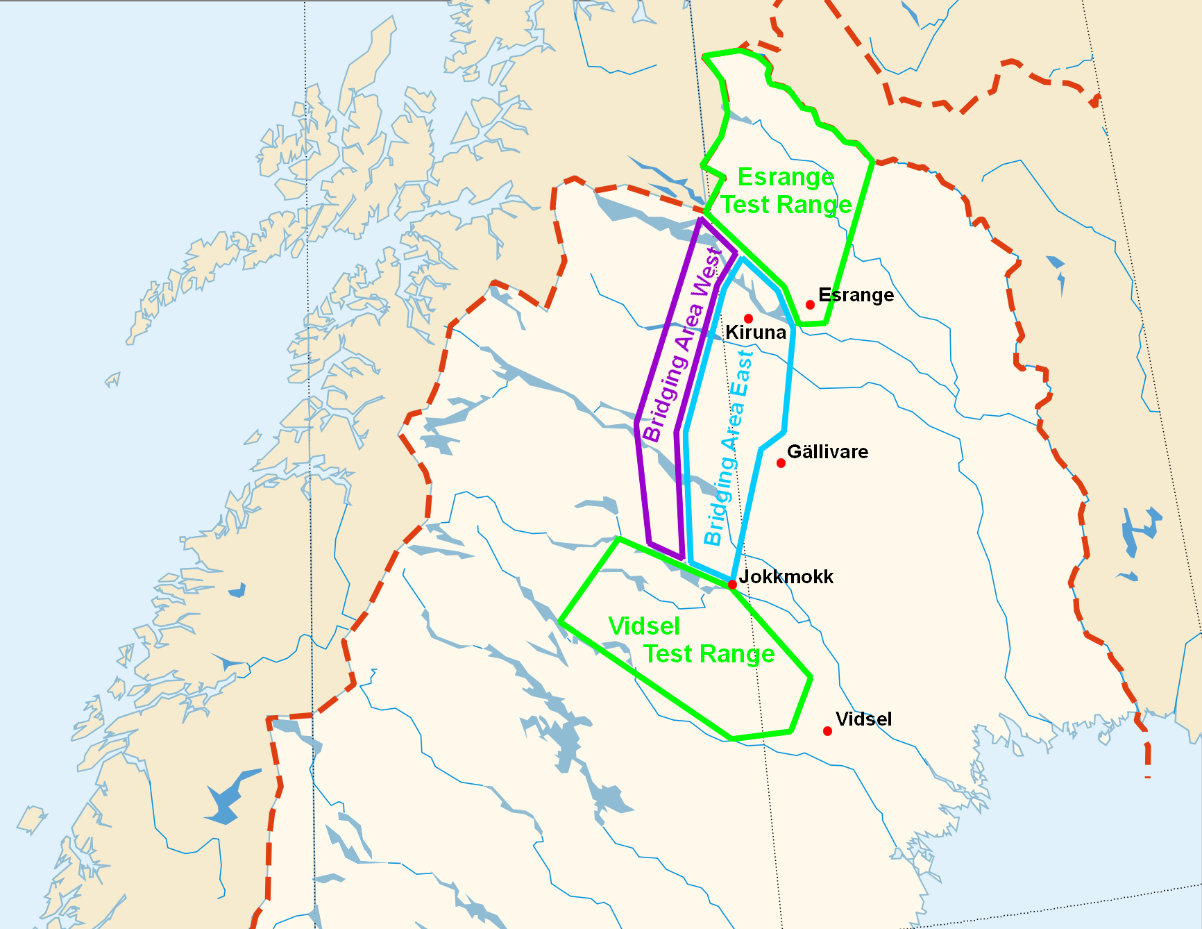
FlightRestrictedZones Esrange Vidsel NEAT. en Flight Restricted Zones of Esrange Vidsel Test Range and NEAT de Kontrollierter gesperrter Luftraum von Esrange Vidsel Test Range und NEAT org MapofSweden polarstereographic svg see source modifications own work File MapofSweden polarstereographic svg Esrange Vidsel Files by User