
Related Images


Download:
| Tiny | 85x128 | View | Download |
| Small | 170x256 | View | Download |
| Medium | 340x512 | View | Download |
| Large | 680x1024 | View | Download |
| Original | 795x1196 | View | Download |
This image was acquired from
wikimedia. It was marked as Public Domain or CC0 and is free to use. To verify, go to the source and check the information there.
Looking for more info about this image?
Try a Google Reverse Image Search for it.
Try a Google Reverse Image Search for it.
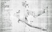
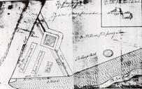
Keywords from Image Description:
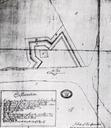
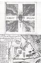
Fort King George Switzermap. Plan of Fort King George's Fort at Allatamaha South Carolina Latitude degrees North This file is public domain since it was created in Georgia Department of Archives and History author Public Domain PDold thcentury fortifications Colonial American Fortifications