Related Images


Download:
| Tiny | 101x128 | View | Download |
| Small | 203x256 | View | Download |
| Medium | 406x512 | View | Download |
| Large | 813x1024 | View | Download |
| Original | 1223x1539 | View | Download |
This image was acquired from
wikimedia. It was marked as Public Domain or CC0 and is free to use. To verify, go to the source and check the information there.
Looking for more info about this image?
Try a Google Reverse Image Search for it.
Try a Google Reverse Image Search for it.
Keywords from Image Description:
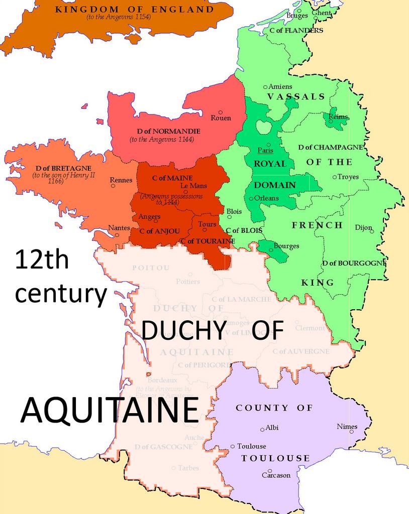
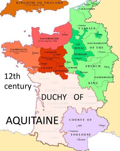
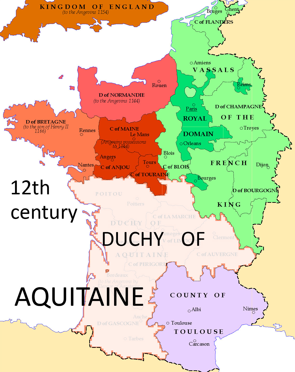
France Eng newAnnotation fullRes . en Map of the Duchy of Aquitaine in the twelfth century Image adapted from File France Eng uploaded by User Lotroo in Category House of Plantagenet and placed in the Public Domain Commons User Richard asr France Eng Richard asr Uploaded with Maps of provinces of France