
Related Images


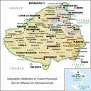
This image was acquired from
wikimedia. It was marked as Public Domain or CC0 and is free to use. To verify, go to the source and check the information there.
Looking for more info about this image?
Try a Google Reverse Image Search for it.
Try a Google Reverse Image Search for it.
Keywords from Image Description:
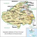
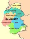
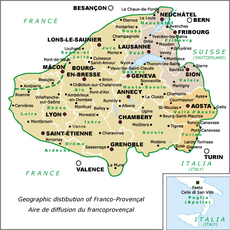
FrancoprovencalGeoMap. FrancoProvenal language map showing cities political divisions Revision selfmade after Tuaillon Le francoprovenal Progrs d'une dfinition in Travaux de Linguistique et de littrature Charvex Replacement for FrancoprovencalGeoMap Maps of the FrancoProvenal language