
Related Images


This image was acquired from
wikimedia. It was marked as Public Domain or CC0 and is free to use. To verify, go to the source and check the information there.
Looking for more info about this image?
Try a Google Reverse Image Search for it.
Try a Google Reverse Image Search for it.
Keywords from Image Description:
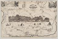
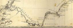
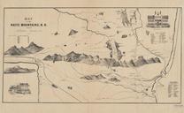
Franklin Leavitt map . en One of the earliest maps of New Hampshire's White Mountains drawn by selftaught artist Franklin Leavitt native of Lancaster New Hampshire The map dates from and is in the collection of Harvard University org html Franklin Leavitt PDold Maps of New Hampshire