Related Images


Download:
| Tiny | 138x128 | View | Download |
| Small | 277x256 | View | Download |
| Medium | 555x512 | View | Download |
| Original | 900x830 | View | Download |
This image was acquired from
wikimedia. It was marked as Public Domain or CC0 and is free to use. To verify, go to the source and check the information there.
Looking for more info about this image?
Try a Google Reverse Image Search for it.
Try a Google Reverse Image Search for it.
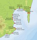
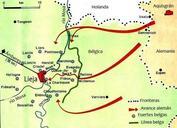
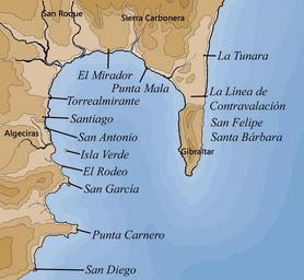
Keywords from Image Description:
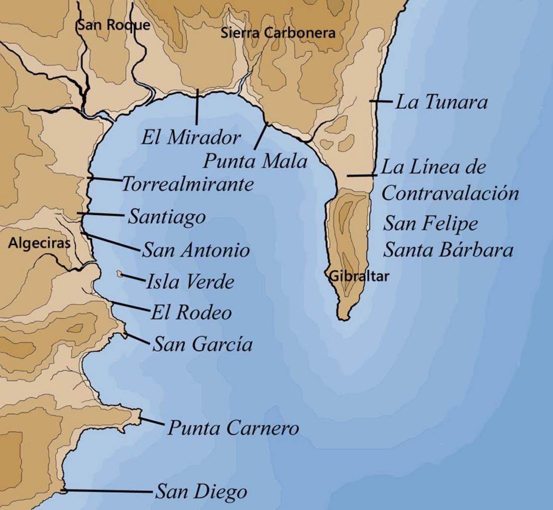
Fuertes. Mapa indicativo de los fuertes del siglo XVIII de la Baha de Algeciras Imagen realizada para own assumed Falconaumanni org CreativeCommons BySa Esta obra est bajo una org licencia de Creative Commons ccbysa es Maps of Algeciras Maps in Spanish Maps of the Bay of Gibraltar GibraltarpediA Forts in Algeciras