Related Images


Download:
| Tiny | 98x128 | View | Download |
| Small | 197x256 | View | Download |
| Medium | 395x512 | View | Download |
| Large | 791x1024 | View | Download |
| Original | 816x1056 | View | Download |
This image was acquired from
wikimedia. It was marked as Public Domain or CC0 and is free to use. To verify, go to the source and check the information there.
Looking for more info about this image?
Try a Google Reverse Image Search for it.
Try a Google Reverse Image Search for it.
Keywords from Image Description:
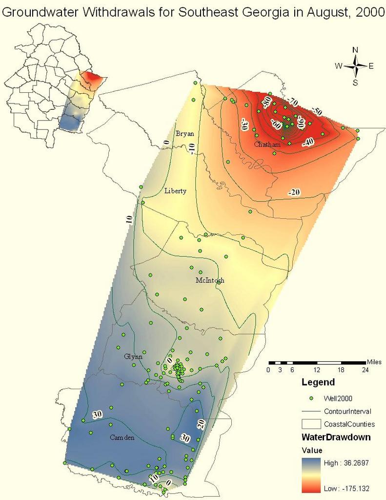
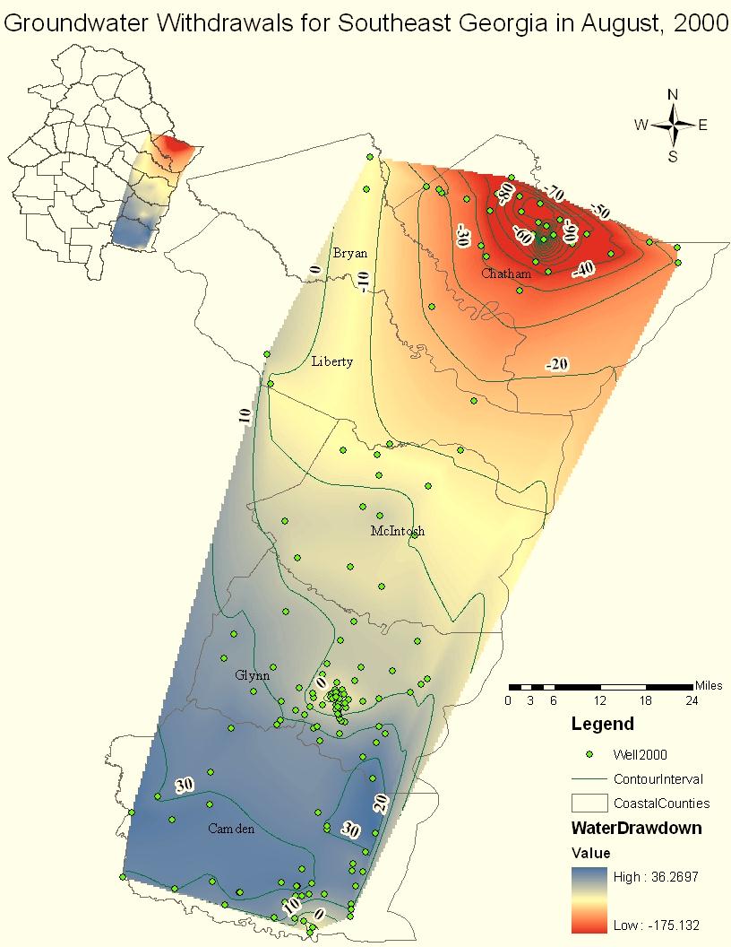
Ga coast. en This is is GIS map of the southeast coast of Georgia which shows the water level in comparison to the sea level The read represents the cone of depression forming and the blue areas are representing the water above the sea level USGS Semir Sarajlic PDUSGov Water in the United States Environmental problems in the United