Related Images


Download:
| Tiny | 104x128 | View | Download |
| Small | 209x256 | View | Download |
| Medium | 418x512 | View | Download |
| Large | 837x1024 | View | Download |
| Original | 5400x6600 | View | Download |
This image was acquired from
flickr. It was marked as Public Domain or CC0 and is free to use. To verify, go to the source and check the information there.
Looking for more info about this image?
Try a Google Reverse Image Search for it.
Try a Google Reverse Image Search for it.
Keywords from Image Description:
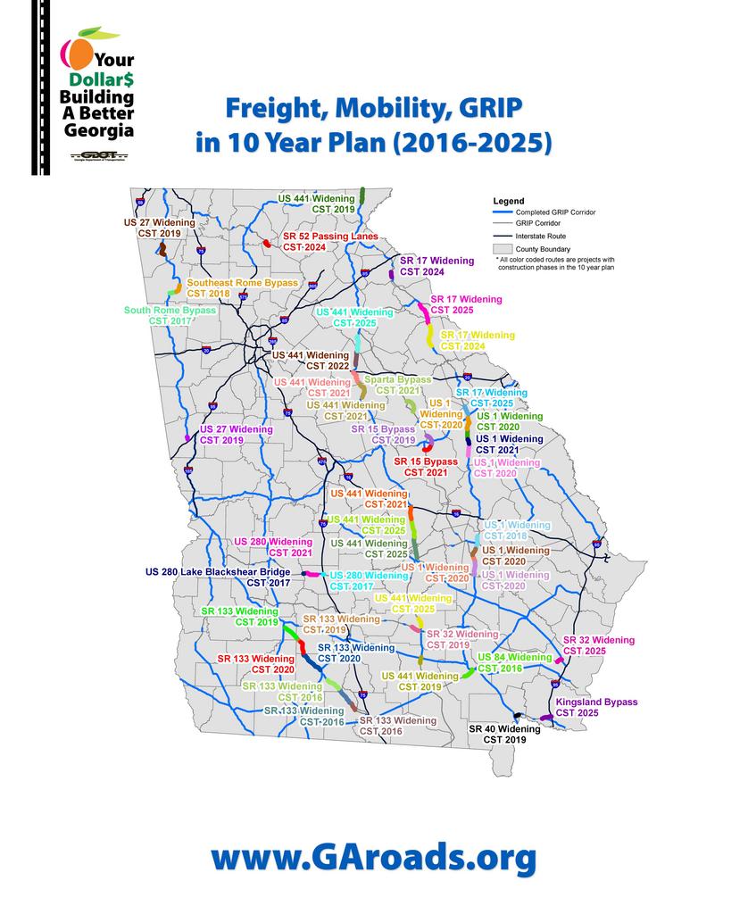
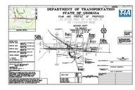
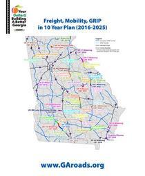
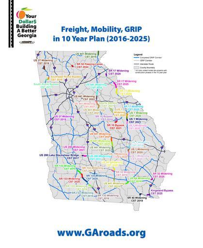
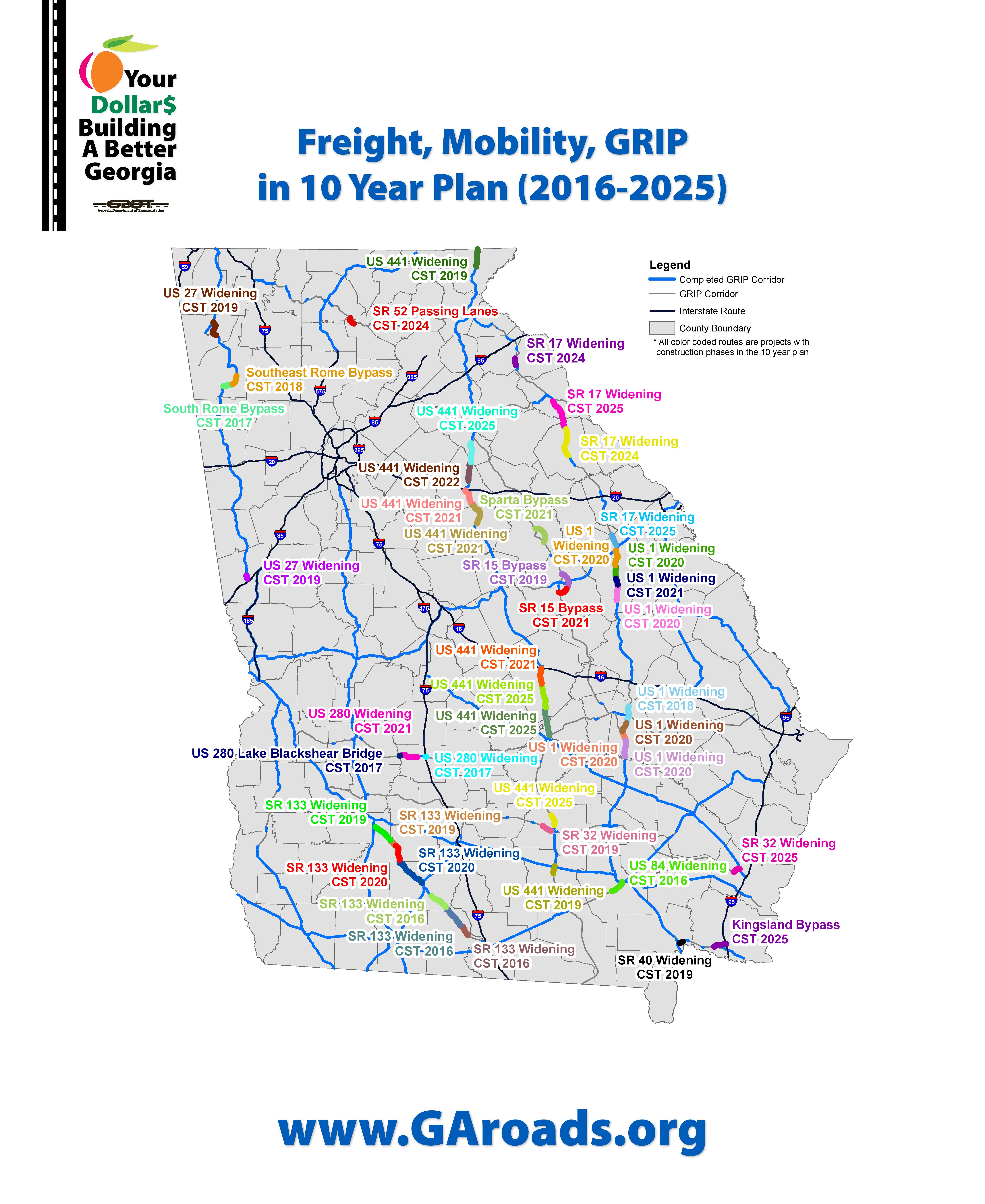
drawing illustration map This is map showing GDOT's investments over the next ten years when it comes to the GRIP corridors. The GRIP program started in the late and it intended to make sure that percent of Georgia's population is within miles of lane highway. This is map showing GDOT's investments over the next ten years when it