
Related Images


Download:
| Tiny | 168x128 | View | Download |
| Small | 336x256 | View | Download |
| Original png | 623x474 | View | Download |
| Original as jpg | 623x474 | View | Download |
This image was acquired from
wikimedia. It was marked as Public Domain or CC0 and is free to use. To verify, go to the source and check the information there.
Looking for more info about this image?
Try a Google Reverse Image Search for it.
Try a Google Reverse Image Search for it.
Keywords from Image Description:
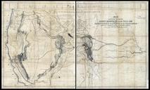
George Mayo Map. Indian territory compiled from the official records of the records of the General Land Office and other sources under supervision of Geo Mayo LOCmap ge ct George Mayo General Land Office Government agency PDUSGov original upload log page en GeorgeMayoMap Oklahombre bytes no Indian territory compiled from