Download:
| Tiny | 79x128 | View | Download |
| Small | 159x256 | View | Download |
| Medium | 319x512 | View | Download |
| Original svg | 533x854 | View | Download |
| Original as jpg | 533x854 | View | Download |
This image was acquired from
wikimedia. It was marked as Public Domain or CC0 and is free to use. To verify, go to the source and check the information there.
Looking for more info about this image?
Try a Google Reverse Image Search for it.
Try a Google Reverse Image Search for it.
Keywords from Image Description:
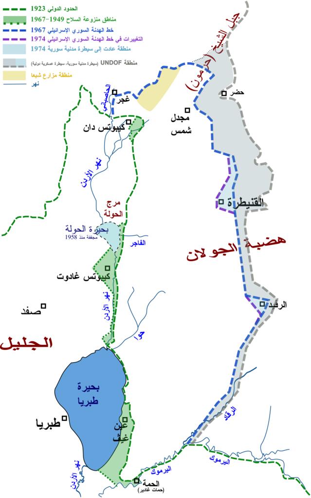
GolanBorders.svg ar en map in Arabic of current and historical borders and ceasefire lines in the Golan Heights region from Own Drork Maps of the Golan Heights Note about accuracy The borders' location and pattern are good approximation according to different resources but they are not meant to be completely accurate
