Download:
| Tiny | 378x128 | View | Download |
| Small | 756x256 | View | Download |
| Original png | 1448x490 | View | Download |
| Original as jpg | 1448x490 | View | Download |
This image was acquired from
wikimedia. It was marked as Public Domain or CC0 and is free to use. To verify, go to the source and check the information there.
Looking for more info about this image?
Try a Google Reverse Image Search for it.
Try a Google Reverse Image Search for it.
Keywords from Image Description:
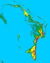
GrandBahama ft shaded. Grand Bahama Island Bahamas shaded at foot meter contour intervals MAP KEY Light Blue ft Green ft Yellow ft Red ft Violet ft Map created with SRTM digital elevation data cr usgs gov Resolution is meters Own Lithiumion Maps of the Bahamas


