
Related Images


Download:
| Tiny | 116x128 | View | Download |
| Small | 232x256 | View | Download |
| Original tiff | 455x502 | View | Download |
| Original as jpg | 455x502 | View | Download |
This image was acquired from
wikimedia. It was marked as Public Domain or CC0 and is free to use. To verify, go to the source and check the information there.
Looking for more info about this image?
Try a Google Reverse Image Search for it.
Try a Google Reverse Image Search for it.
Keywords from Image Description:
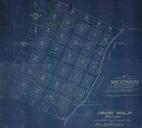
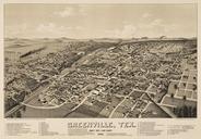
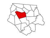
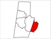
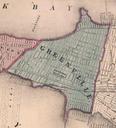
GreenvilleJCmap. en Map of Greenville one year before the township voted to consolidate with Jersey City becoming the southernmost section of the city bordering Bayonne Newark Bay lies to the west above and Upper New York Bay lies to east below Subsequent reclamation in the th century increased the land area rutgers edu Atlas