
Related Images


Download:
| Tiny | 106x128 | View | Download |
| Small | 212x256 | View | Download |
| Medium | 425x512 | View | Download |
| Large | 851x1024 | View | Download |
| Original gif | 2640x3173 | View | Download |
| Original as jpg | 2640x3173 | View | Download |
This image was acquired from
wikimedia. It was marked as Public Domain or CC0 and is free to use. To verify, go to the source and check the information there.
Looking for more info about this image?
Try a Google Reverse Image Search for it.
Try a Google Reverse Image Search for it.
Keywords from Image Description:
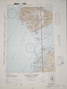
GrlmapOstenfeld. en Original caption Map of the Arctic regions showing the limit of the treated area Sketch map of the Arctic as it was mapped around biggest gaps are in NE Greenland Ostenfeld Flora Arctica Carl Hansen Ostenfeld PDOld Carl Hansen Ostenfeld Old maps of the Arctic History of geography Polar research Maps with azimuthal