Related Images


Download:
| Tiny | 143x128 | View | Download |
| Small | 287x256 | View | Download |
| Medium | 575x512 | View | Download |
| Original | 737x656 | View | Download |
This image was acquired from
wikimedia. It was marked as Public Domain or CC0 and is free to use. To verify, go to the source and check the information there.
Looking for more info about this image?
Try a Google Reverse Image Search for it.
Try a Google Reverse Image Search for it.
Keywords from Image Description:
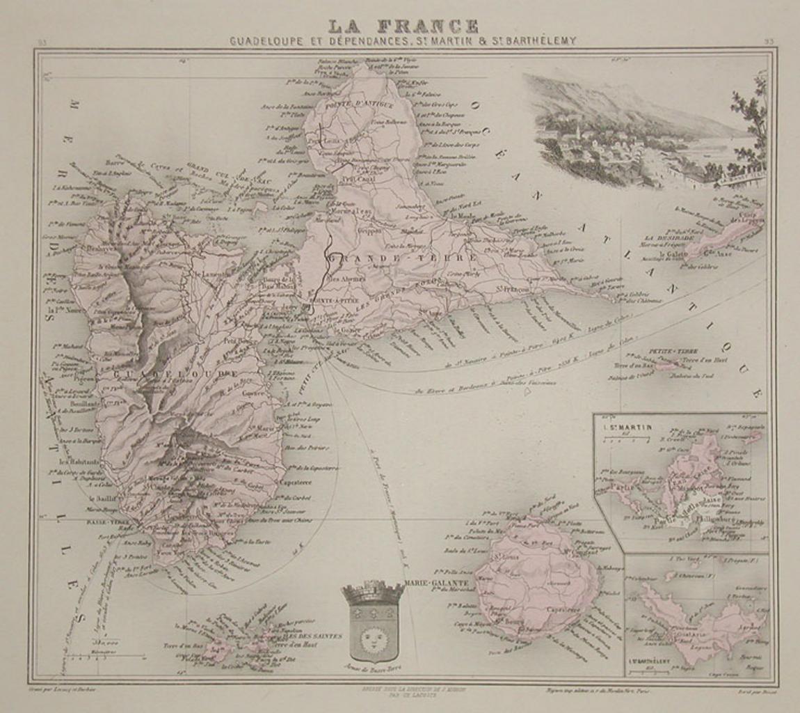
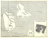
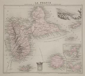
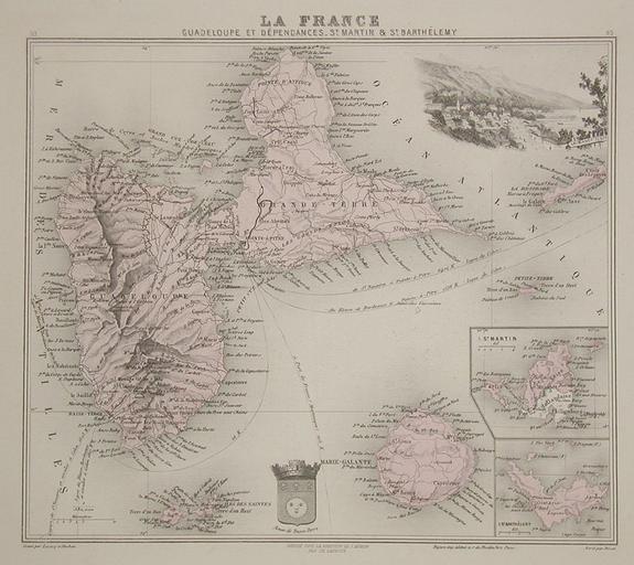
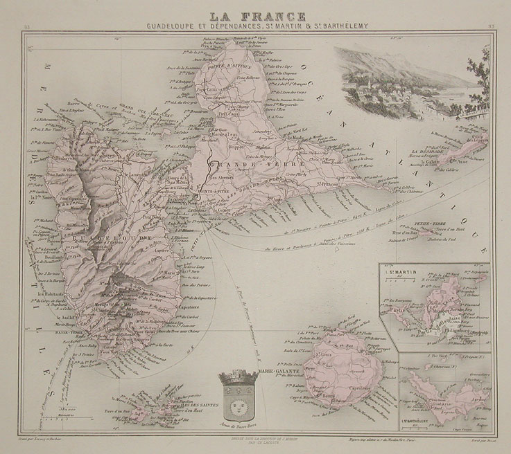
Guadeloupe. Handcoloured map of Guadeloupe centre Saint Martin centre right and Saint Barthlemy bottom right An illustration of BasseTerre is shown in the top right corner of the map bergbook Islands htm Paris Migeon PDold maps Old maps of Guadeloupe Coats of arms on maps