
Related Images


Download:
| Tiny | 134x128 | View | Download |
| Small | 269x256 | View | Download |
| Medium | 538x512 | View | Download |
| Large | 1077x1024 | View | Download |
| Original svg | 12472x11854 | View | Download |
| Original as jpg | 12472x11854 | View | Download |
This image was acquired from
wikimedia. It was marked as Public Domain or CC0 and is free to use. To verify, go to the source and check the information there.
Looking for more info about this image?
Try a Google Reverse Image Search for it.
Try a Google Reverse Image Search for it.
Keywords from Image Description:
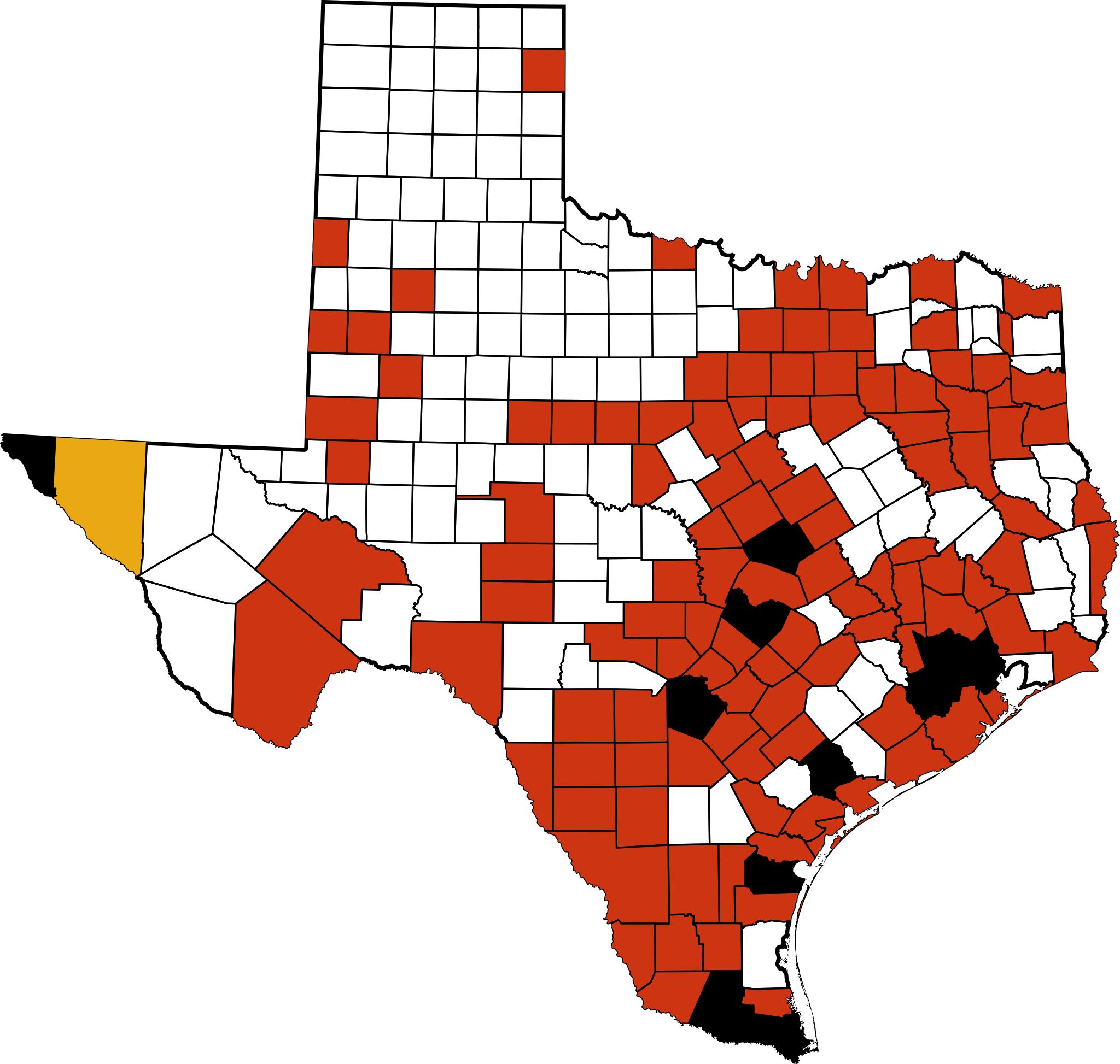
HN Texas map.svg This is locator map showing swine flu outbreak in the United States in Texas by county David Benbennick made the original map For more information see Commons United States county locator maps Collegebookworm made this derivative map MapofTexashighlightingFortBendCounty svg UTC MapofTexashighlightingFortBendCounty