
Related Images


Download:
| Tiny | 222x128 | View | Download |
| Small | 445x256 | View | Download |
| Original png | 836x480 | View | Download |
| Original as jpg | 836x480 | View | Download |
This image was acquired from
wikimedia. It was marked as Public Domain or CC0 and is free to use. To verify, go to the source and check the information there.
Looking for more info about this image?
Try a Google Reverse Image Search for it.
Try a Google Reverse Image Search for it.
Keywords from Image Description:
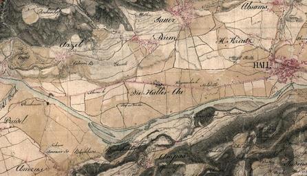
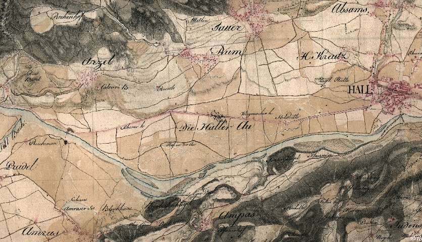
Haller Au . Haller Au Inntal zwischen Innsbruck und Hall um Josephinische Landesaufnahme via tirisdienste at dll Name anich Cmd Start Historische Kartenwerke Tirol TIRIS Topographische Anstalt Topographischlithographische Anstalt des Generalquartiermeisterstabs PDold First Military Mapping Survey of Austrian Empire Austria Details