
Related Images


Download:
| Tiny | 114x128 | View | Download |
| Small | 228x256 | View | Download |
| Medium | 457x512 | View | Download |
| Large | 915x1024 | View | Download |
| Original png | 1198x1340 | View | Download |
| Original as jpg | 1198x1340 | View | Download |
This image was acquired from
wikimedia. It was marked as Public Domain or CC0 and is free to use. To verify, go to the source and check the information there.
Looking for more info about this image?
Try a Google Reverse Image Search for it.
Try a Google Reverse Image Search for it.
Keywords from Image Description:
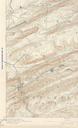
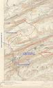
Historic Mountain Home Alameda County and Mountain House Creek . en This is the southeast portion of the USGS Topo Map of for the Byron Quadrangle California USGS Topo Map at lib utexas edu USGS Topographical Map other versions PDUSGov Alameda County California