
Related Images


Download:
| Tiny | 196x128 | View | Download |
| Small | 392x256 | View | Download |
| Medium | 785x512 | View | Download |
| Large | 1571x1024 | View | Download |
| Original | 4519x2944 | View | Download |
This image was acquired from
wikimedia. It was marked as Public Domain or CC0 and is free to use. To verify, go to the source and check the information there.
Looking for more info about this image?
Try a Google Reverse Image Search for it.
Try a Google Reverse Image Search for it.
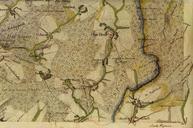
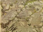
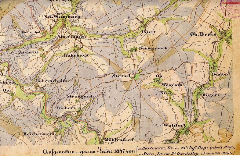
Keywords from Image Description:
HKAltenkirchen C. Preuische Kartenaufnahme Uraufnahme Blatt Altenkirchen Westerwald Hartmann nrdl Hlfte Stein sdl Hlfte Kateer August CEST Scan Repro PDold Historical maps of Landkreis Altenkirchen Westerwald Maps by Royal Prussian Land Survey