Related Images


Download:
| Tiny | 93x128 | View | Download |
| Small | 187x256 | View | Download |
| Medium | 374x512 | View | Download |
| Large | 749x1024 | View | Download |
| Original png | 881x1204 | View | Download |
| Original as jpg | 881x1204 | View | Download |
This image was acquired from
wikimedia. It was marked as Public Domain or CC0 and is free to use. To verify, go to the source and check the information there.
Looking for more info about this image?
Try a Google Reverse Image Search for it.
Try a Google Reverse Image Search for it.
Keywords from Image Description:
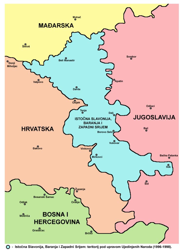
Hrvatsko Podunavlje. en Map of the Eastern Slavonia Baranja and Western Syrmia Croatian language version hr Mapa Istone Slavonije Baranje Zapadnog Srijema verzija na hrvatskom jeziku Srembaranja UTC Srembaranja It's been copied from english where it had PD self Licensing from its author en user PANONIAN derivative work Ex