Related Images


Download:
| Tiny | 204x128 | View | Download |
| Small | 409x256 | View | Download |
| Medium | 819x512 | View | Download |
| Large | 1638x1024 | View | Download |
| Original | 3840x2400 | View | Download |
This image was acquired from
flickr. It was marked as Public Domain or CC0 and is free to use. To verify, go to the source and check the information there.
Looking for more info about this image?
Try a Google Reverse Image Search for it.
Try a Google Reverse Image Search for it.
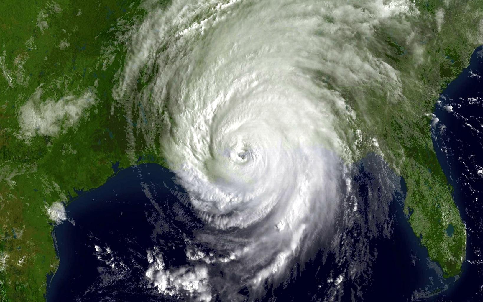
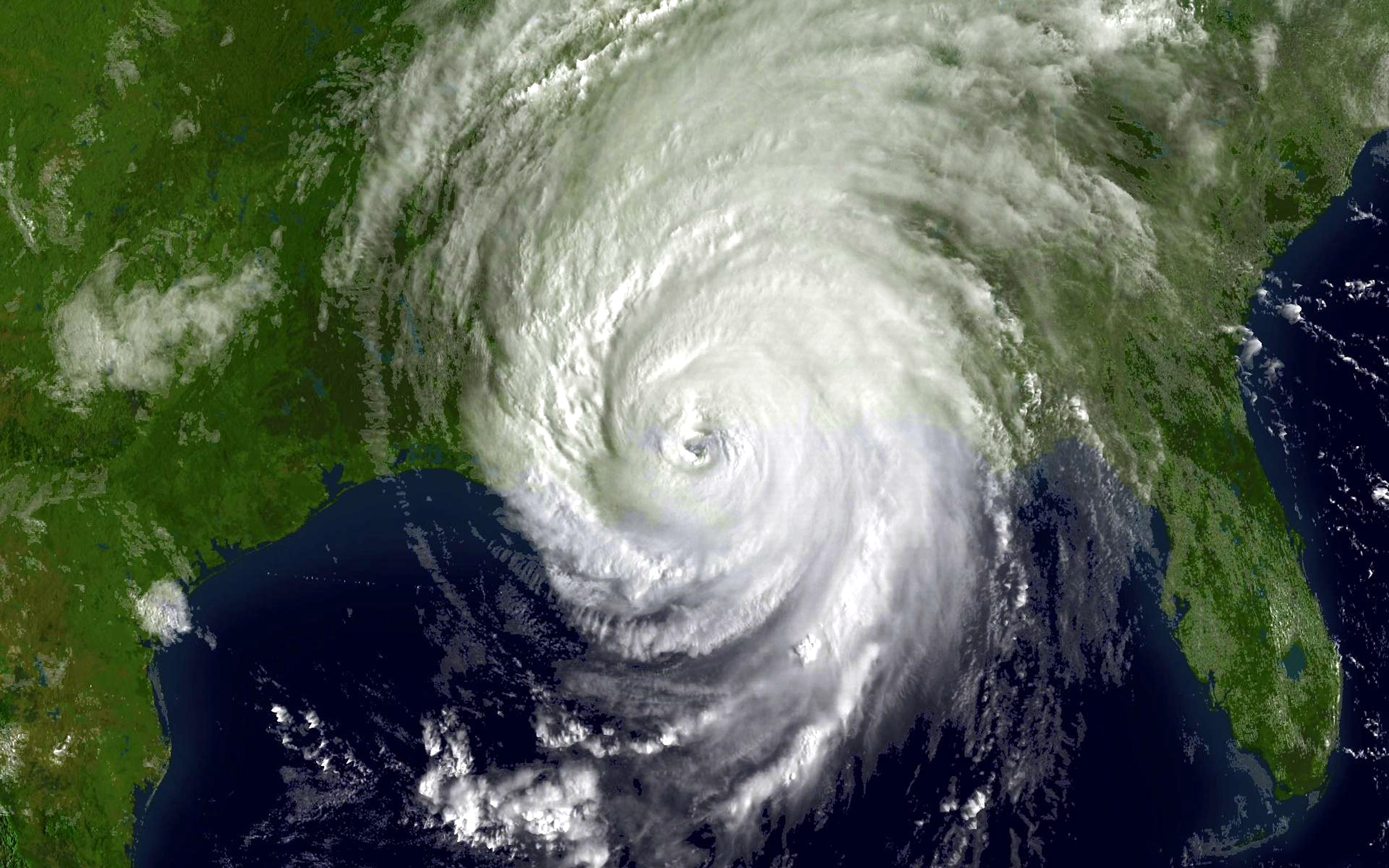
Keywords from Image Description:
noaa katrina satellite hurricane gulf mexico outdoor Hurricane Katrina shortly after landfall August as captured by NOAA's GOES weather satellite. NOAA forecasters track hurricanes using realtime data from NOAAs polar orbiting and geostationary weather satellites as well as ocean and coastal observing systems and landbased radars.