
Related Images

Download:
| Tiny | 459x128 | View | Download |
| Small | 918x256 | View | Download |
| Medium | 1836x512 | View | Download |
| Original | 2002x558 | View | Download |
This image was acquired from
wikimedia. It was marked as Public Domain or CC0 and is free to use. To verify, go to the source and check the information there.
Looking for more info about this image?
Try a Google Reverse Image Search for it.
Try a Google Reverse Image Search for it.
Keywords from Image Description:
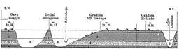
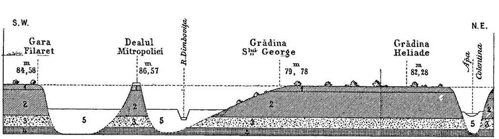
I. P. Licherdopol Seciunea transversal solului Bucuretilor. en SWtoNE hydrogeological cross section through the plains of Bucharest Romania cm represents km The hachures represent Red loess Yellow loess Sand and gravel Tertiary clay Modern alluvium The high points on the map indicate left to right Filaret Station Mitropoliei