
Related Images


Download:
| Tiny | 79x128 | View | Download |
| Small | 159x256 | View | Download |
| Medium | 319x512 | View | Download |
| Original svg | 637x1021 | View | Download |
| Original as jpg | 637x1021 | View | Download |
This image was acquired from
wikimedia. It was marked as Public Domain or CC0 and is free to use. To verify, go to the source and check the information there.
Looking for more info about this image?
Try a Google Reverse Image Search for it.
Try a Google Reverse Image Search for it.
Keywords from Image Description:
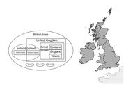
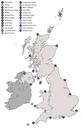
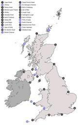
Inshore Waters of Great Britain.svg Map showing the locations of areas mentioned in the inshore weather report of the Shipping Forecast Numbers in grey circles represent area delimiters letters in blue circles represent other important bodies of water and islands BritishIslesUnitedKingdom svg UTC derivative work Smurrayinchester