
Related Images


Download:
| Tiny | 119x128 | View | Download |
| Small | 239x256 | View | Download |
| Original png | 330x353 | View | Download |
| Original as jpg | 330x353 | View | Download |
This image was acquired from
wikimedia. It was marked as Public Domain or CC0 and is free to use. To verify, go to the source and check the information there.
Looking for more info about this image?
Try a Google Reverse Image Search for it.
Try a Google Reverse Image Search for it.
Keywords from Image Description:
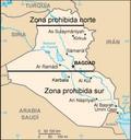
Irak zona exclusion aerea. es Mapa de Irak en el que se sealan las zonas de exclusin area prohibidas para la aviacin al norte sur de determinados paralelos IraqNOFLYZONES UTC IraqNOFLYZONES USA Goverment derivative work DPC talk Spanish translation David Perez IraqNOFLYZONES PDUSGov Original upload log This image is derivative