
Related Images


Download:
| Tiny | 151x128 | View | Download |
| Small | 302x256 | View | Download |
| Medium | 604x512 | View | Download |
| Original | 900x762 | View | Download |
This image was acquired from
wikimedia. It was marked as Public Domain or CC0 and is free to use. To verify, go to the source and check the information there.
Looking for more info about this image?
Try a Google Reverse Image Search for it.
Try a Google Reverse Image Search for it.
Keywords from Image Description:
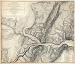
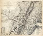
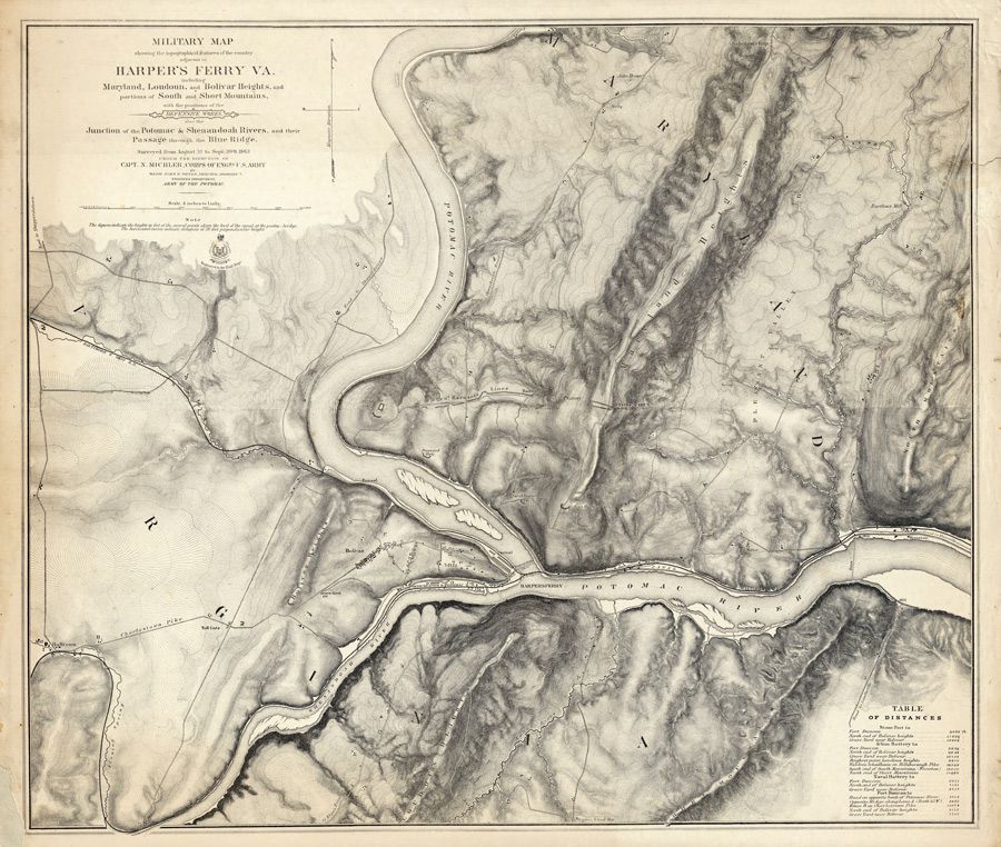
John E. Weyss. en Military map showing the topography of the country around Harper's Ferry Va including Maryland Loudoun and Bolivar Heights and portions of South and Short Mountains with the positions of the Defensive Works also the Junction of the Potomac Shenandoah Rivers and their passage through the Blue Ridge Surveyed from