Related Images


Download:
| Tiny | 164x128 | View | Download |
| Small | 329x256 | View | Download |
| Original png | 640x497 | View | Download |
| Original as jpg | 640x497 | View | Download |
This image was acquired from
wikimedia. It was marked as Public Domain or CC0 and is free to use. To verify, go to the source and check the information there.
Looking for more info about this image?
Try a Google Reverse Image Search for it.
Try a Google Reverse Image Search for it.
Keywords from Image Description:
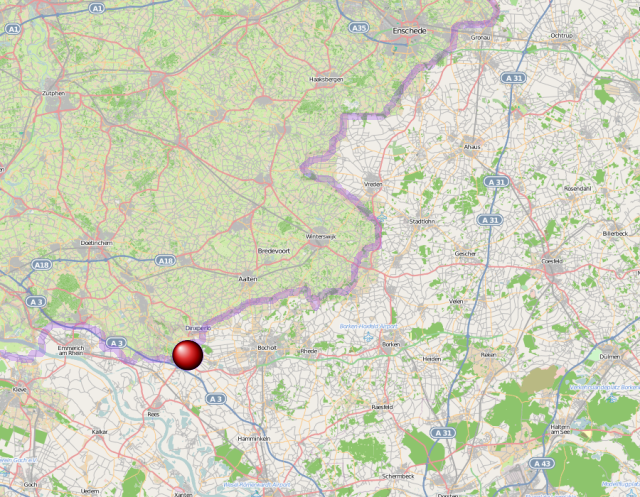
Kaart anholt. Locator maps of municipalities of GelderlandWestfalen nl Referentiekaart van Provincie Gelderland met indeling van gemeenten en impressie van het landschap Samengesteld uit publiek beschikbare geodata Referentieondergrond kustlijn steden wegen gerasterd uit de OpenStreet Map OSM openstreetmap org html Inhoud is beschikbaar