
Related Images


Download:
| Tiny | 143x128 | View | Download |
| Small | 286x256 | View | Download |
| Medium | 573x512 | View | Download |
| Large | 1147x1024 | View | Download |
| Original | 1902x1698 | View | Download |
This image was acquired from
wikimedia. It was marked as Public Domain or CC0 and is free to use. To verify, go to the source and check the information there.
Looking for more info about this image?
Try a Google Reverse Image Search for it.
Try a Google Reverse Image Search for it.
Keywords from Image Description:
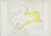
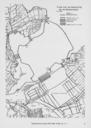
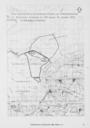
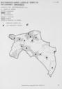
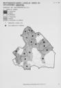
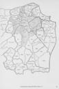
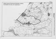
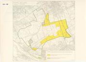
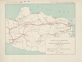
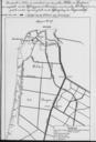
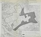
KAARTEN SGD Begrenzing landinrichtingsgebied en te onteigenen gebied Midden Delfland.jpeg accession number en The individual creators of this map are unknown it was commissioned by the House of Representatives of the Netherlands Bijlage van de Memorie van Toelichting betreffende Regelen met betrekking tot de reconstructie van MiddenDelfland