
Related Images


Download:
| Tiny | 89x128 | View | Download |
| Small | 178x256 | View | Download |
| Medium | 357x512 | View | Download |
| Large | 714x1024 | View | Download |
| Original | 1761x2525 | View | Download |
This image was acquired from
wikimedia. It was marked as Public Domain or CC0 and is free to use. To verify, go to the source and check the information there.
Looking for more info about this image?
Try a Google Reverse Image Search for it.
Try a Google Reverse Image Search for it.
Keywords from Image Description:
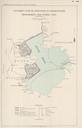
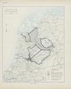
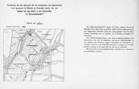
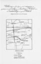
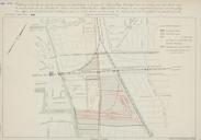
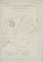
KAARTEN SGD Ontwerp voor de afsluiting en droogmaking van een gedeelte der Zuiderzee.jpeg accession number en The individual creators of this map are unknown it was commissioned by the House of Representatives of the Netherlands Voor de Wieringermeer zijn op de kaart de afdelingen en het aantal hectare onderscheiden en zijn de benodigde