
Related Images


Download:
| Tiny | 75x128 | View | Download |
| Small | 151x256 | View | Download |
| Medium | 302x512 | View | Download |
| Large | 604x1024 | View | Download |
| Original png | 1120x1898 | View | Download |
| Original as jpg | 1120x1898 | View | Download |
This image was acquired from
wikimedia. It was marked as Public Domain or CC0 and is free to use. To verify, go to the source and check the information there.
Looking for more info about this image?
Try a Google Reverse Image Search for it.
Try a Google Reverse Image Search for it.
Keywords from Image Description:
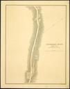
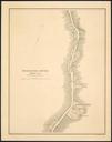
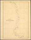
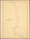
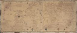
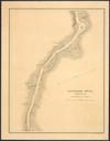
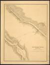
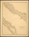
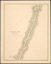
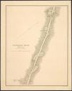
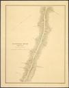
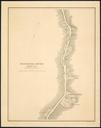
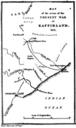
Kaffirland map. en sketch map of the region of South Africa called Kaffirland in the Five years in Kaffirland with sketches of the late war in that country to the conclusion of peace written on the spot Third edition London Harriet Ward Map by her husband other versions PDold South Africa in the British Empire in the s