Related Images


Download:
| Tiny | 174x128 | View | Download |
| Small | 349x256 | View | Download |
| Medium | 699x512 | View | Download |
| Large | 1398x1024 | View | Download |
| Original | 3480x2548 | View | Download |
This image was acquired from
wikimedia. It was marked as Public Domain or CC0 and is free to use. To verify, go to the source and check the information there.
Looking for more info about this image?
Try a Google Reverse Image Search for it.
Try a Google Reverse Image Search for it.
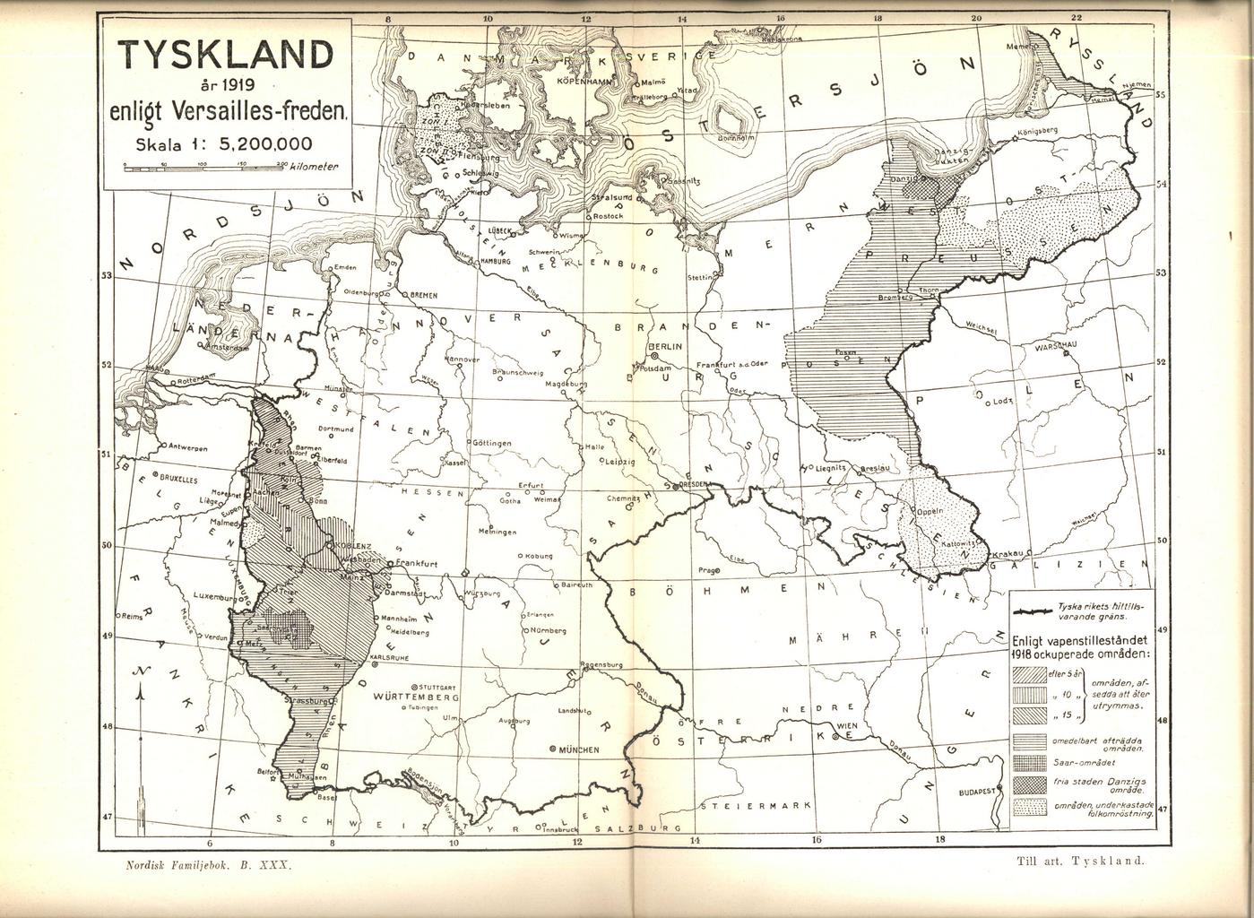
Keywords from Image Description:
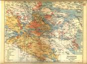
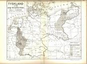
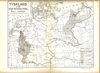
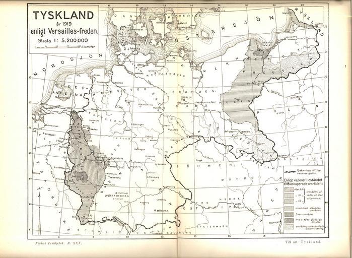
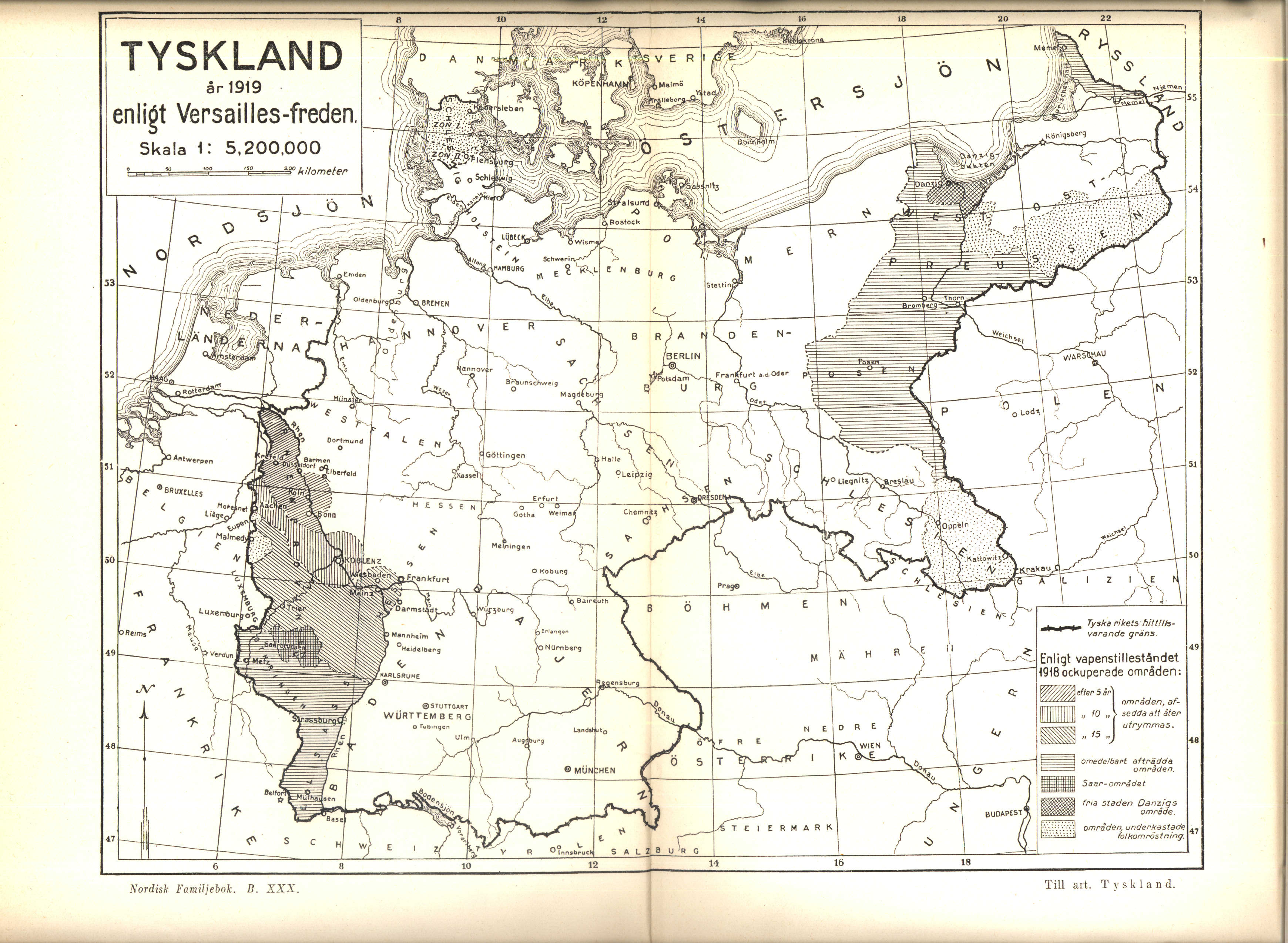
Karta ver Tyskland enligt Versaillesfreden ur Nordisk familjebok. Karta ver Tyskland enligt Versaillesfreden Map of Germany according to the Versailles treaty Source Nordisk familjebok PDUgglan Old maps of the German Empire Maps showing thcentury history Allied occupation of the Rhineland Treaty of Versailles Files in need of sources