
Related Images


Download:
| Tiny | 155x128 | View | Download |
| Small | 311x256 | View | Download |
| Medium | 623x512 | View | Download |
| Large | 1247x1024 | View | Download |
| Original | 2410x1978 | View | Download |
This image was acquired from
wikimedia. It was marked as Public Domain or CC0 and is free to use. To verify, go to the source and check the information there.
Looking for more info about this image?
Try a Google Reverse Image Search for it.
Try a Google Reverse Image Search for it.
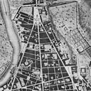
Keywords from Image Description:
Kasbergmapgreyscales. Grfenberg gehrt Die Karte ist das Uraufnahmeblatt NW aus der Sammlung der Ortsbltter der Landvermessung in Bayern von Durch die zweifache Reproduktion gibt es erhebliche Qualittseinbuen im Vergleich zum Original welches auerdem im Gegensatz zu diesem Graustufenbild in Farbe ist Grfenberg Germany from Scan