
Related Images


Download:
| Tiny | 153x128 | View | Download |
| Small | 307x256 | View | Download |
| Medium | 615x512 | View | Download |
| Original png | 770x641 | View | Download |
| Original as jpg | 770x641 | View | Download |
This image was acquired from
wikimedia. It was marked as Public Domain or CC0 and is free to use. To verify, go to the source and check the information there.
Looking for more info about this image?
Try a Google Reverse Image Search for it.
Try a Google Reverse Image Search for it.
Keywords from Image Description:
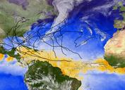
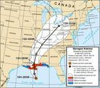
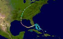
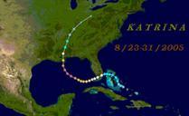
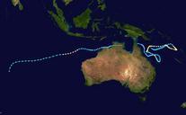
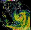
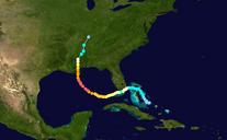
Katrina Path. Hurricane Katrina Track is based on various sources including National Weather Service National Hurricane Centre and WWLTV radar image The latest information is based on The Weather Channel Hurricane Katrina maps own assumed Vsion